Marine distance calculations
Get accurate distance measurements between seaports.

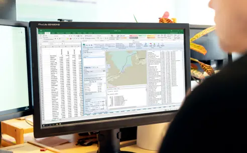
AtoBviaC marine distance calculations
Get accurate and reliable marine distances and route calculations with our range of AtoBviaC products - the easiest way to get the distances between ports worldwide. Whether you want a few distances per year or a fully integrated system, our AtoBviaC range of software has a solution for you.
Advantages of AtoBviaC
Accurate calculations
Accuracy is maintained with regular releases of the AtoBviaC software range.

Realistic results
Route legs reviewed by experienced Mariners to ensure route calculations are realistic.

Wide range of applications
Versatile products to suit your needs with affordable solutions online and for Windows PCs.
Industry recognition
AtoBviaC Marine Distance Tables have a history of being the definitive distance provider to the shipping industry and continue to be the standard for marine distance calculations.
Accurate distances
All distances are based on a contemporary network of routes maintained on a weekly basis by AtoBviaC using Admiralty Notices to Mariners, making sure the results are accurate and realistic. Having accurate results on how long it takes to sail between ports is essential when navigating, to give you the easiest and most efficient way to get from one port to another.
AtoBviaC applications available
All the Marine Distance Tables products from AtoBviaC include the following:
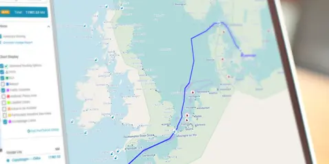
- Fully respect all mandatory and recommended traffic separation schemes (as a result, the distance between ports A and B is not necessarily the same as from B to A)
- Allow the user to change the routing between ports
- Include comprehensive coverage of oil, dry bulk, gas and container ports
- Deliver the shortest reduced environmental impact route as a default
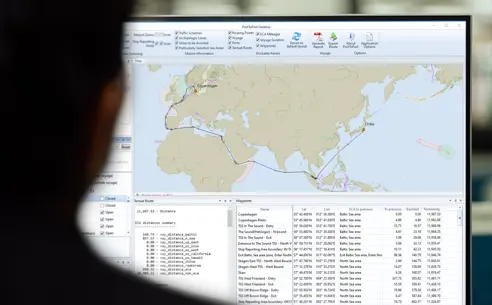
- Use industry approved formulae for calculating the distances for Rhumb Line and Great Circle distances
- Determine the exact position of both the starting and ending point of a voyage - in a large port this will be a central safe position within the port; for an offshore terminal it will be the waiting area for that terminal; for a single berth it will be a position just off the berth
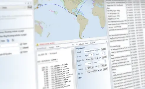
- Offers the ability to calculate distances within ECA (Emission Control Area) zones
They provide a graphical display of:
- Emission Control Areas - Shows currently in force and shortly to be implemented ECAs and calculates distances within those areas
- Marpol - identifies special areas as defined by the Marpol convention
- JWC Piracy - displays the latest Joint War Committee recommendations on Piracy, Terrorism and Related Perils
- Load Lines - Shows international loadline zones and calculates distances within the zones
Do you need help?
AtoBviaC has its own website with full product and purchasing details. Click here to visit AtoBviaC.com
Go to AtoBviaC.com